
Storm Readiness Report
A storm-readiness report for linemen, utility workers, emergency responders, and contracting companies — situational awareness of where storms are driving increased impact to the U.S. grid and where power outages could occur.
Recent briefings
Real briefings we've recently sent — open one to read it in full.
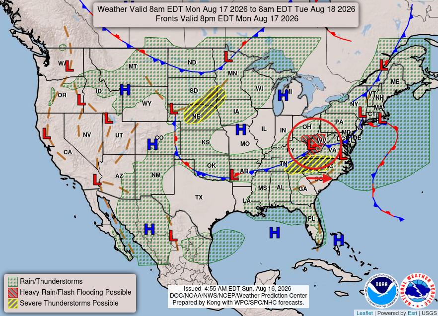
8/17/26 - Active Weather Pattern Continues
An active storm filled pattern continues for much of the Midwest as fronts and storms continue to pop up and impact many states.
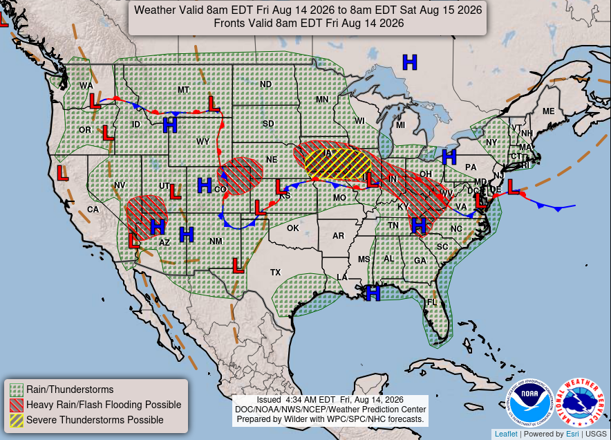
8/14/26 Storm Readiness Report
High Alert for the Midwest
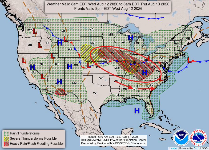
8/12/26 Midwest Severe Weather (Alert Level: High)
Today marks another round of severe weather moving through the Midwest and Mid-Atlantic states. Impacts to replicate what occurred in the previous 24 hours in roughly the same impacted areas. High heat, Late Summer Storms = Increased Severe Weather Threats.
An active storm filled pattern continues for much of the Midwest as fronts and storms continue to pop up and impact many states.
An Editor's Read
As we head into the middle of August, we maintain a pretty consistent pattern of storms moving through the area. Much of the Midwest and surrounding areas should be on high alert as we have more severe weather potential and systems moving through the area this week. We anticipate some of the same areas to be impacted as the week progresses with pop - up storm developments. Be sure to stay alert and keep your head on a swivel as conditions can change quickly.
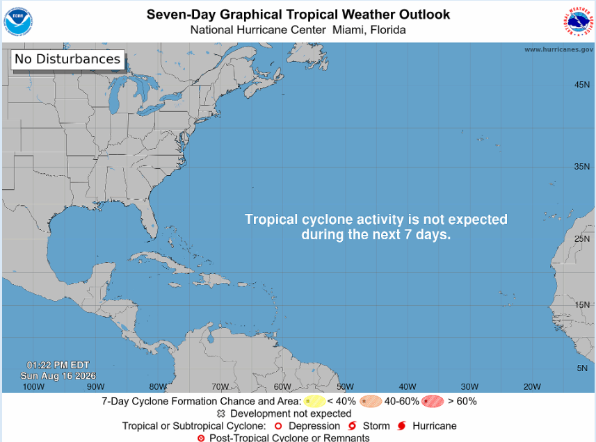
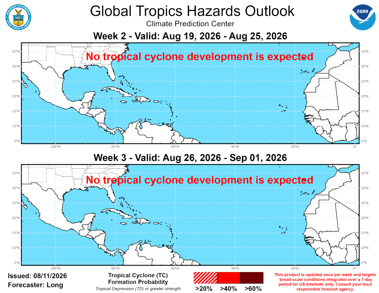
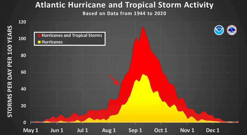
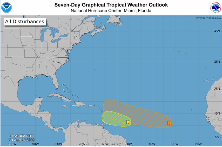
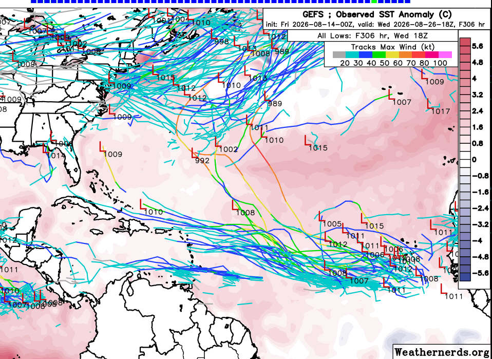
A look into the Tropics - Not much on the horizon now through the beginning of September. The areas once marked as potential areas of development have been eliminated due to windshear, Saharan dust, and impacts from a strong El-Nino Year. This doesn't mean storms can't pop up, always have a plan in place and stay alert. Remember, it only takes one storm.
Impact Maps
storm track + weather outlook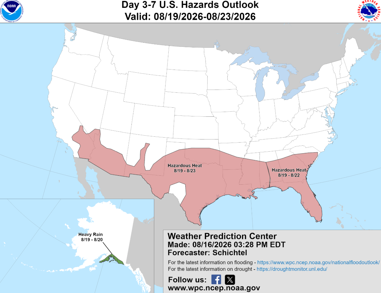
Current Major Outages
Ranked by customers affected · pulled fresh at sendData accurate as of 7:01 AM ET Time.
You're receiving this because you subscribed to the Storm Readiness Report. No longer want these? Unsubscribe — it takes effect immediately.
High Alert for the Midwest
An Editor's Read
We have continued patterns of stormy weather in the same impacted areas from this past week. Keep your head on a swivel as changing conditions are likely to occur as steady as it's been this week with storms impacting many states, mainly the Midwest.
Impact Maps
storm track + weather outlook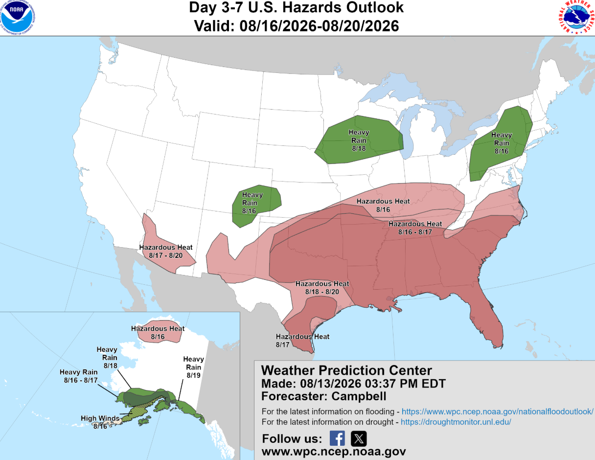
Current Major Outages
Ranked by customers affected · pulled fresh at sendData accurate as of 7:02 AM ET Time.
You're receiving this because you subscribed to the Storm Readiness Report. No longer want these? Unsubscribe — it takes effect immediately.
Today marks another round of severe weather moving through the Midwest and Mid-Atlantic states. Impacts to replicate what occurred in the previous 24 hours in roughly the same impacted areas. High heat, Late Summer Storms = Increased Severe Weather Threats.
An Editor's Read
Today marks another round of severe weather moving through the Midwest and Mid-Atlantic states. Impacts to replicate what occurred in the previous 24 hours in roughly the same impacted areas. High heat, Late Summer Storms = Increased Severe Weather Threats.
Impact Maps
storm track + weather outlook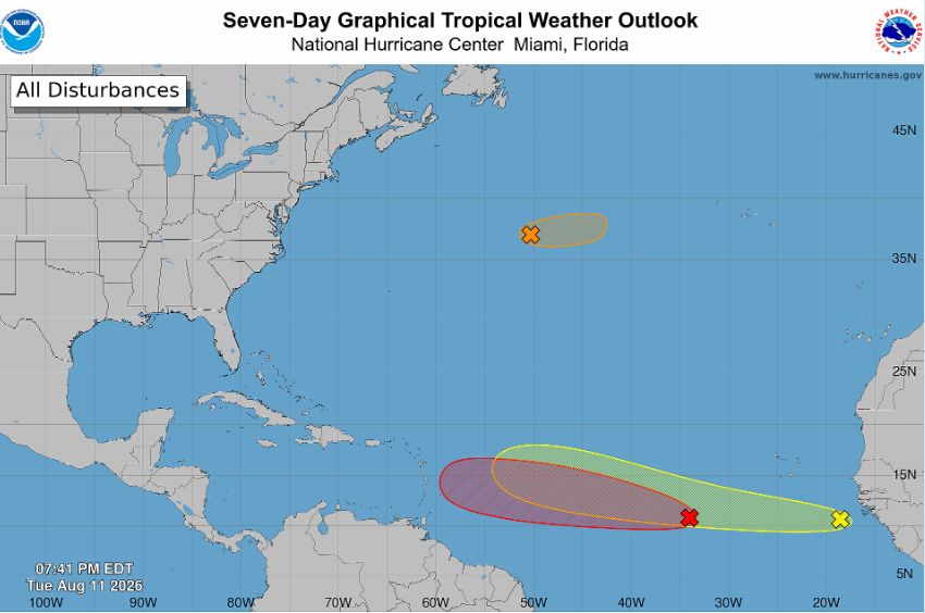
Current Major Outages
Ranked by customers affected · pulled fresh at sendData accurate as of 7:01 AM ET Time.
You're receiving this because you subscribed to the Storm Readiness Report. No longer want these? Unsubscribe — it takes effect immediately.
Four blocks, every briefing


Current major outages
Top active events ranked by customers affected, with the 24-hour change — pulled fresh at send.

Editor's watch list
The utilities most at risk over the next 24–72 hours, with a plain risk level and the driver.

An editor's read
A short, professional narrative — written for ops people, acronyms intact, no marketing fluff.

Impact maps
An impact map embedded right in the email so you can brief your team at a glance.
It picks up when the grid does
Quiet weeks stay quiet. When weather turns, the briefing turns with it.
A few mornings a week
Your baseline operational read — active major outages, an editor's watch list, and a short narrative.
Daily during significant weather
When a system is moving in, you get a briefing every morning so nothing creeps up on your crews.
Several times a day
During a named storm or major event, updates run throughout the day.
Get the next briefing
One step. No password. Active immediately.